

Map of Mali - With glowing point and lines scales on The Dark Gradient Background, 3D mesh polygonal network connections. Vector illustration .
Коллекция по умолчанию
Коллекция по умолчанию
Создать новую

Mali map flag coat
Коллекция по умолчанию
Коллекция по умолчанию
Создать новую

Mali map and flag
Коллекция по умолчанию
Коллекция по умолчанию
Создать новую

Vector collection with silhouettes of Mali map with national flag and marked state regions
Коллекция по умолчанию
Коллекция по умолчанию
Создать новую

Map of Mali - With glowing point and lines scales on The Dark Gradient Background, 3D mesh polygonal network connections. Vector illustration eps10.
Коллекция по умолчанию
Коллекция по умолчанию
Создать новую

Brazil on the map. Brazil on the world map.
Коллекция по умолчанию
Коллекция по умолчанию
Создать новую

Benin Flag Over World Map, Selectiove Focus
Коллекция по умолчанию
Коллекция по умолчанию
Создать новую

Guinea flag with some soft highlights and folds
Коллекция по умолчанию
Коллекция по умолчанию
Создать новую

A closeup map of Europe found on a globe of the Earth.
Коллекция по умолчанию
Коллекция по умолчанию
Создать новую

Hand marking Paris on map with red pin
Коллекция по умолчанию
Коллекция по умолчанию
Создать новую

Top-down view of Mauritania hightlighted in red as seen from Earth's orbit in space. 3D illustration with highly detailed realistic planet surface.
Коллекция по умолчанию
Коллекция по умолчанию
Создать новую

Equatorial Guinea, Malabo - national flag pinned on political map - 3D illustration
Коллекция по умолчанию
Коллекция по умолчанию
Создать новую

Americas map, Americas location , United States of America map
Коллекция по умолчанию
Коллекция по умолчанию
Создать новую

Mauritania in red on realistic map with embossed countries. 3D illustration.
Коллекция по умолчанию
Коллекция по умолчанию
Создать новую

Senegal on digital map with networks. Concept of international travel, communication and technology. 3D illustration.
Коллекция по умолчанию
Коллекция по умолчанию
Создать новую

Western Africa from space on model of planet Earth with country borders and very detailed planet surface and clouds. 3D illustration.
Коллекция по умолчанию
Коллекция по умолчанию
Создать новую

close up of a world map with the city of Amman in focus
Коллекция по умолчанию
Коллекция по умолчанию
Создать новую

Map of the world
Коллекция по умолчанию
Коллекция по умолчанию
Создать новую

Zambia on digital map with networks. Concept of international travel, communication and technology. 3D illustration.
Коллекция по умолчанию
Коллекция по умолчанию
Создать новую

Northern, region of Uganda. Colored elevation map with lakes and rivers
Коллекция по умолчанию
Коллекция по умолчанию
Создать новую

Evening over Mauritania as seen from space on planet Earth with visible border lines and city lights. 3D illustration.
Коллекция по умолчанию
Коллекция по умолчанию
Создать новую

Horn of Africa from space with country borders and trajectories representing global communication, travel, connections. 3D illustration.
Коллекция по умолчанию
Коллекция по умолчанию
Создать новую

puzzle with the national flag of belgium and guinea bissau on a world map background. 3D illustration
Коллекция по умолчанию
Коллекция по умолчанию
Создать новую

Central Africa on digital planet Earth from space with network. Concept of international communication, technology and travel. 3D illustration.
Коллекция по умолчанию
Коллекция по умолчанию
Создать новую

Illustration of Sudan as seen from Earth’s orbit in late evening. 3D illustration.
Коллекция по умолчанию
Коллекция по умолчанию
Создать новую

Orbit view of Libya highlighted in red with visible borderlines on planet Earth. 3D illustration.
Коллекция по умолчанию
Коллекция по умолчанию
Создать новую

Nigeria highlighted in red on physical map. 3D illustration.
Коллекция по умолчанию
Коллекция по умолчанию
Создать новую

Space orbit view of Ghana highlighted in red on planet Earth at night with visible country borders and city lights. 3D illustration.
Коллекция по умолчанию
Коллекция по умолчанию
Создать новую

Democratic Republic of the Congo, Kinshasa - national flag pinned on political map - 3D illustration
Коллекция по умолчанию
Коллекция по умолчанию
Создать новую

Kenya on planet Earth from space with network. Concept of international communication, technology and travel. 3D illustration.
Коллекция по умолчанию
Коллекция по умолчанию
Создать новую

Senegal, Dakar - national flag pinned on political map - 3D illustration
Коллекция по умолчанию
Коллекция по умолчанию
Создать новую

Chad highlighted on 3D Earth with visible countries and watery oceans. 3D illustration.
Коллекция по умолчанию
Коллекция по умолчанию
Создать новую

Morning above Mali highlighted in red on model of planet Earth in space. 3D illustration.
Коллекция по умолчанию
Коллекция по умолчанию
Создать новую

A map of Senegal with the national flag of Senegal on it. The flag is a tricolor consisting of three vertical green, yellow, and red bands charged with a five-pointed green star at the center. Travel and government concept
Коллекция по умолчанию
Коллекция по умолчанию
Создать новую

Illustration of Mauritania as seen from Earth’s orbit on planet Earth. 3D illustration.
Коллекция по умолчанию
Коллекция по умолчанию
Создать новую

Ivory Coast on green model of planet Earth with network at night. Concept of digital technology, communication and travel. 3D illustration.
Коллекция по умолчанию
Коллекция по умолчанию
Создать новую

South Africa on model of planet Earth with network representing travel and communication. 3D illustration.
Коллекция по умолчанию
Коллекция по умолчанию
Создать новую

Map of mali with main cities in pastel green
Коллекция по умолчанию
Коллекция по умолчанию
Создать новую

Botswana highlighted in red on illustrated globe with realistic ocean waters and clouds as seen from Earth's orbit in space. 3D illustration with high level of detail. Elements of this image furnished by NASA.
Коллекция по умолчанию
Коллекция по умолчанию
Создать новую

Map Of America
Коллекция по умолчанию
Коллекция по умолчанию
Создать новую

Africa. Coronavirus COVID-19 global cases Map. Red Dot showing the number of infected. Johns Hopkins University map on monitor display.
Коллекция по умолчанию
Коллекция по умолчанию
Создать новую

Evening over Mali as seen from space on planet Earth. 3D illustration.
Коллекция по умолчанию
Коллекция по умолчанию
Создать новую

abkhazia Map World map News Communication delivery gold yellow
Коллекция по умолчанию
Коллекция по умолчанию
Создать новую

Sudan from space on model of Earth with international network. Concept of digital communication or travel. 3D illustration.
Коллекция по умолчанию
Коллекция по умолчанию
Создать новую

Cameroon, Yaounde - national flag pinned on political map - 3D illustration
Коллекция по умолчанию
Коллекция по умолчанию
Создать новую

Guinea
Коллекция по умолчанию
Коллекция по умолчанию
Создать новую

Gambia from space on model of planet Earth with networks. Detailed planet surface with city lights. 3D illustration.
Коллекция по умолчанию
Коллекция по умолчанию
Создать новую

Map of Senegal with embedded flag on planet surface. 3D illustration.
Коллекция по умолчанию
Коллекция по умолчанию
Создать новую

India map on vintage crack paper background, selective focus
Коллекция по умолчанию
Коллекция по умолчанию
Создать новую

Map of Benin with embedded flag on planet surface. 3D illustration.
Коллекция по умолчанию
Коллекция по умолчанию
Создать новую

Coahuila, State of Mexico. Low resolution satellite maps
Коллекция по умолчанию
Коллекция по умолчанию
Создать новую

Illustration of Burkina Faso as seen from Earth’s orbit during sunset with visible country borders. 3D illustration.
Коллекция по умолчанию
Коллекция по умолчанию
Создать новую

Bringing global network and data exchanges to life through 3D rendering.
Коллекция по умолчанию
Коллекция по умолчанию
Создать новую

puzzle with the national flag of barbados and comoros on a world map background. 3D illustration
Коллекция по умолчанию
Коллекция по умолчанию
Создать новую
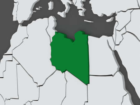
Map of worlds. Libya. 3d
Коллекция по умолчанию
Коллекция по умолчанию
Создать новую

puzzle with the national flag of guatemala and ghana on a world map background. 3D illustration
Коллекция по умолчанию
Коллекция по умолчанию
Создать новую

Red clerical needle on a map of the USA, Arizona and the capital Phoenix. Close up map of orizona with red tack, US map pin
Коллекция по умолчанию
Коллекция по умолчанию
Создать новую

Illustration of Benin on political globe with embedded flag. 3D illustration.
Коллекция по умолчанию
Коллекция по умолчанию
Создать новую

Country of Cameroon in red on planet Earth. 3D illustration.
Коллекция по умолчанию
Коллекция по умолчанию
Создать новую

Horn of Africa from space on realistic model of planet Earth with country borders and detailed planet surface and clouds. 3D illustration.
Коллекция по умолчанию
Коллекция по умолчанию
Создать новую

Dry soil pattern on the flag of Senegal. Country with drought concept. water problem. Dry cracked earth country.
Коллекция по умолчанию
Коллекция по умолчанию
Создать новую

Western Sahara from space on model of planet Earth with country borders. Extremely fine detail of planet surface and clouds. 3D illustration.
Коллекция по умолчанию
Коллекция по умолчанию
Создать новую

Africa with highlighted Central African Republic map. Vector Illustration.
Коллекция по умолчанию
Коллекция по умолчанию
Создать новую

Mali official national flag and coat of arms, african country, vector illustration
Коллекция по умолчанию
Коллекция по умолчанию
Создать новую

Burkina Faso as seen from Earth’s orbit on planet Earth highlighted in red with visible borders. 3D illustration.
Коллекция по умолчанию
Коллекция по умолчанию
Создать новую

Map of Senegal on cracked texture isolated on white
Коллекция по умолчанию
Коллекция по умолчанию
Создать новую

Map of worlds. Libya. 3d
Коллекция по умолчанию
Коллекция по умолчанию
Создать новую

a tree in the middle of an empty street
Коллекция по умолчанию
Коллекция по умолчанию
Создать новую

Niger on planet planet Earth with country borders. Extremely detailed planet surface and clouds. 3D illustration.
Коллекция по умолчанию
Коллекция по умолчанию
Создать новую

Flag of Madagascar on the world map. The concept of tourism and recreation.
Коллекция по умолчанию
Коллекция по умолчанию
Создать новую

South Sudan on planet Earth with international network representing communication, travel and connections. 3D illustration.
Коллекция по умолчанию
Коллекция по умолчанию
Создать новую

Sunrise above Paraguay highlighted in red on model of planet Earth in space with visible country borders. 3D illustration.
Коллекция по умолчанию
Коллекция по умолчанию
Создать новую

Zimbabwe in early morning light highlighted in red on planet Earth. 3D illustration.
Коллекция по умолчанию
Коллекция по умолчанию
Создать новую

Botswana in red on blue political map. 3D illustration.
Коллекция по умолчанию
Коллекция по умолчанию
Создать новую

Macro of Poland on a globe, narrow depth of field
Коллекция по умолчанию
Коллекция по умолчанию
Создать новую

Map of Cameroon with embedded flag on planet surface. 3D illustration.
Коллекция по умолчанию
Коллекция по умолчанию
Создать новую

Africa with highlighted Chad map. Vector Illustration.
Коллекция по умолчанию
Коллекция по умолчанию
Создать новую

Close up of finger pointing to Helsinki, Finland on colorful map, background blur
Коллекция по умолчанию
Коллекция по умолчанию
Создать новую

Waving Irish and Italian flags of the political map of the world
Коллекция по умолчанию
Коллекция по умолчанию
Создать новую

Senegal with national flag on blue political globe. 3D illustration.
Коллекция по умолчанию
Коллекция по умолчанию
Создать новую

Illustration of Niger as seen from Earth’s orbit in late evening with visible border lines and city lights. 3D illustration.
Коллекция по умолчанию
Коллекция по умолчанию
Создать новую

Gabon on digital map with networks. Concept of international travel, communication and technology. 3D illustration.
Коллекция по умолчанию
Коллекция по умолчанию
Создать новую

Mali with national flag on political globe. 3D illustration.
Коллекция по умолчанию
Коллекция по умолчанию
Создать новую

Lesotho from orbit of planet Earth in sunrise with highly detailed surface textures and visible country borders. 3D illustration.
Коллекция по умолчанию
Коллекция по умолчанию
Создать новую

Waving Romanian and Bulgarian flags of the political map of the world
Коллекция по умолчанию
Коллекция по умолчанию
Создать новую

Burkina Faso from space on model of planet Earth with country borders and very detailed planet surface. 3D illustration.
Коллекция по умолчанию
Коллекция по умолчанию
Создать новую

Browser window with map of Chad, searching Chad in internet. Modern browser window template.
Коллекция по умолчанию
Коллекция по умолчанию
Создать новую

Equatorial Guinea on green model of planet Earth with network representing digital age, travel and communication. 3D illustration.
Коллекция по умолчанию
Коллекция по умолчанию
Создать новую

National flag of Mali
Коллекция по умолчанию
Коллекция по умолчанию
Создать новую

flags of Germany and Bulgaria painted on cracked wall
Коллекция по умолчанию
Коллекция по умолчанию
Создать новую

Map of Mali with the flag of Mali in the contour of the map on a trip abstract backdrop. Travel illustration.
Коллекция по умолчанию
Коллекция по умолчанию
Создать новую

Mali from orbit of planet Earth in sunrise with highly detailed surface textures and visible country borders. 3D illustration.
Коллекция по умолчанию
Коллекция по умолчанию
Создать новую

Abstract map of Africa on a black background. Polygonal network connections ai generated
Коллекция по умолчанию
Коллекция по умолчанию
Создать новую

Cameroon highlighted on 3D Earth with visible countries and watery oceans. 3D illustration.
Коллекция по умолчанию
Коллекция по умолчанию
Создать новую

Burkina Faso with embedded flag on political globe. 3D illustration.
Коллекция по умолчанию
Коллекция по умолчанию
Создать новую

Sudan in red on realistic map with embossed countries. 3D illustration.
Коллекция по умолчанию
Коллекция по умолчанию
Создать новую

Burkina Faso with national flag on blue political 3D globe. 3D illustration.
Коллекция по умолчанию
Коллекция по умолчанию
Создать новую

Mali during sunrise highlighted in red on planet Earth with visible country borders. 3D illustration.
Коллекция по умолчанию
Коллекция по умолчанию
Создать новую

Burkina Faso on planet planet Earth with network. Concept of connectivity, travel and communication. 3D illustration.
Коллекция по умолчанию
Коллекция по умолчанию
Создать новую

Varanasi India November 19, 2018 View of a unknown Sadhu smoking a chillum in the streets of Varanasi in the afternoon
Коллекция по умолчанию
Коллекция по умолчанию
Создать новую
Legion-Media
Создайте свои проекты на основе качественных стоковых фотографий и видео.


Copyright © Legion-Media.